Automatic Location Visualization Using the Easy Map Design Software

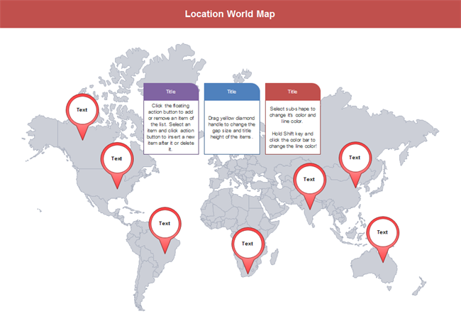
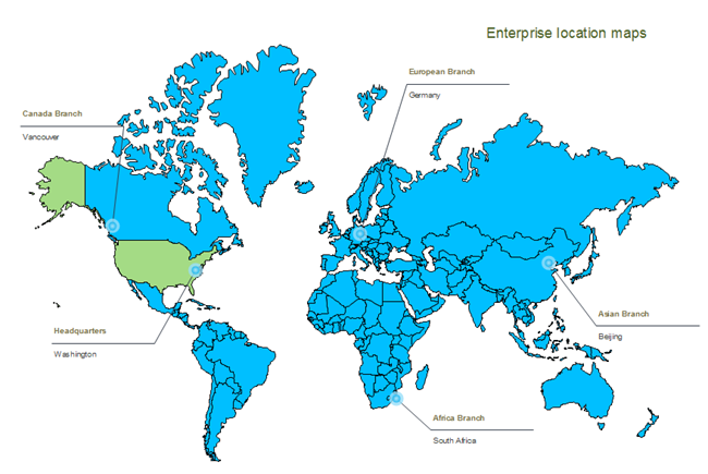
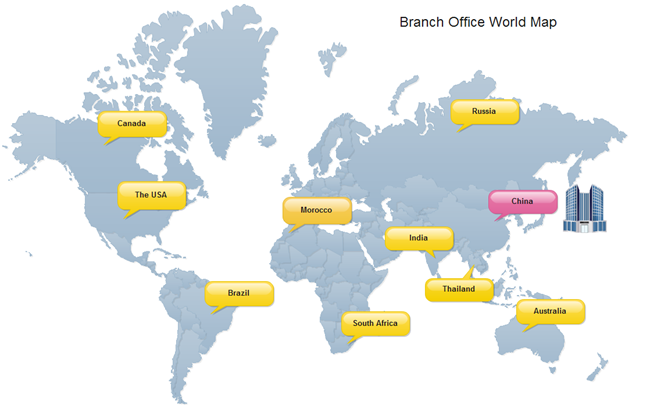
Visualize the geographical location of corporations, your own houses or any other places so that they can be easily accessible. Learn how to do it automatically with predefined shapes and templates. You can learn how to be book smart in school but you may still be street foolish. Use visualized maps is a good way to help you to be street savvy. They help you navigate more easily when you are lost. See how Edraw can help you and your friends and families in terms of navigation.

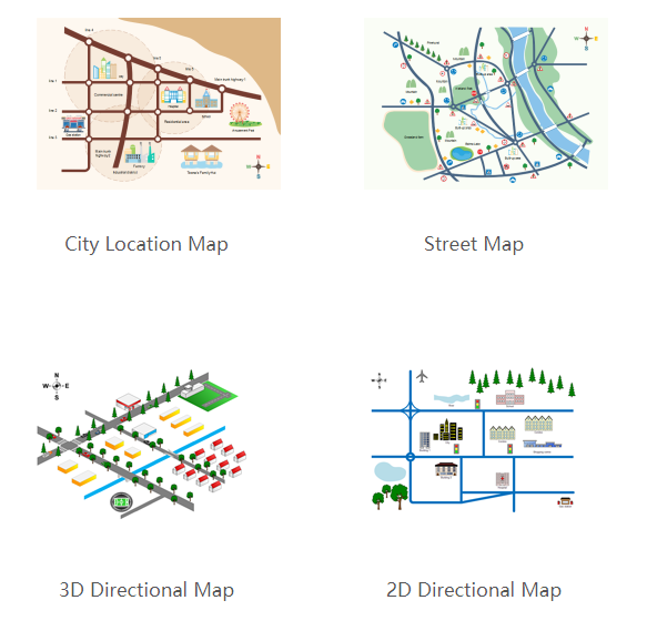
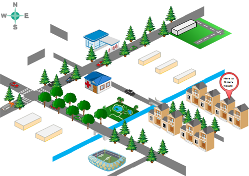
Show Your House Clearly in a 3D Directional Map

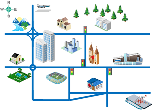
From time to time, you want to invite friends to your home, have a party in your house or something like that. To be considerate, you had better tell them the detailed address. The invitee will feel your hospitality more if you send a 3D Directional Map, showing the nearby streets, surrounding environment and adjacent buildings. This is sure of great help for those who are easy to get lost and feel hard to read general maps. Check out the following example.

3D Directional Map

Display Your Company Attractively

How can you present your advantages to talents you want to hire? The potential employees may get the first impression of your organization from the interview invitation email you send to them. A visualized map helps you display the location advantage to the best. Another bonus with having a map visualization is that it also helps interviewees find your place easily. They can also feel the humanistic care of your organization. Take a look at the example of Office Position drawn by Edraw.

Map of Office Position

How to Visualize Geographical Location

Edraw brings forward an array of exciting features at the fingertips of drawers. You don’t need to worry about drawing skills. All you need to do is to drag, drop, and click. Follow the steps below to gain your own directional map.

  • Start Edraw. It enters File menu by default with the Available Templates list and Templates window opened together.
  • Choose Maps in the Available Templates list.
  • Double click Directional Maps or Directional Map – 3D to enter the drawing window.

Template Icons

  • 4 libraries are opened on the left titled Landmarks, Road Shapes, Road signs and Map Vehicles. And the drawing page is on the right.

Libraries

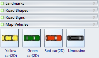
  • Click the title of the library you need. For example, click Landmark to view all landmark shapes.
  • Drag suitable shapes onto the blank page. For example, drag the Building or Suburban Home shape to represent your house.

Building Shape Suburban Home Shape

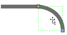
  • Connect shapes when necessary. For instance, all road shapes have connection points. When you drag one shape to another, the connection points turn red indicating shapes are connected.

Connect Shapes

  • Repeat the steps of dragging and connecting shapes until all objects you want to display are included.

Highlight a Certain Place

You can use callouts to highlight a place, which is the main purpose of mapping. There is a Callout shape in the Landmarks group (the last one). Drag it to your desired position and then double-click it to fill in the description. If you need other types of the callout, get them from the Libraries button. To add a description to a specific place, do the followings.

  • Click the Libraries button.
  • Scroll down to select General type.
  • Click Callout.

Read More:

Automatic Location Visualization

Customizable World Map Presentation Templates – with Location Markers

World Map with Location Markers

If you need editable world map templates for presenting enterprise locations, doing marketing report presentation, showing air routes, planning travels, or educating students, here you can find rich resources.

Here are the features:

  1. All world map templates you see below are high-resolution designs in vector format. When resized, there will be no clarity loss.
  2. They are editable, which means you can change the colors and fill effects, insert location markers, add descriptions, alter backgrounds, highlight a country, etc.
  3. The markers, description shapes, highlight callouts, connectors, and clip arts are pre-made in the software. You don’t need to bother to look for or to create those symbols. Everything is ready; just use.
  4. What the “vector” means is that each country is a separate map, if you need the map of a certain country or a certain continent, simply ungroup the map, and take that part.
  5. The files can be exported to many different formats, including PDF, PPT, Word, Html, SVG, JPG, and a lot more.

World Map Template – Location World Map

World maps sometimes can be used for creating business presentations. For example, a company’s sales department might use a world map for international sales analysis during a meeting. This customizable world map is available to download. You can change its color and add built-in description boxes with different styles.

world map location

World Map Template – Highlight a Country

This template is presented to illustrate the feature of highlighting a special part.

World Map

World Map Template – with Highlight Indicators

The template is highly customizable and coming with a great range of built-in indicators for choosing. In addition, a large collection of clip arts are included, which are very handy for creating business presentations.

Branch Office World Map

World Map Template – Market Report

This template is practical for marketing reports. The built-in pie chart shapes with smart behaviors let you quickly visualize the marketing data and make a compelling presentation that impresses the audience.

Market Report World Map

World Map Template – World Air Routes Map

Creating a visually appealing air routes map is just a few clicks away with Edraw. You can have the following template and customize for your own use.

World Air Routes Map

World Map Template – World Population Map

The world population map marks population in each continent with different colors. The pie chart in the bottom left indicates the detailed proportion of the population in the world, Asia has the largest while Oceania has the least.

World Population Map

World Map Template – Dots World Map

The creative dots world map features forming the shape of five continents with dots in five colors. The continent shape made up of dots is not as accurate as the map above.

Dots World Map

World Map Template – World Map with Pointers

Here is a world map with orange pointers in the beige background. If the pointers locate in places of interest, the pie chart in the bottom left can be used to compare the proportion of visitor traffic in these scenic spots.

World Map with Pointers

World Map Template – Pointers and Flags World Map

The following is a world map in the light blue background with an ornamented frame. The main part is elliptical with blue symbolizing the ocean and white symbolizing the land. Red flags, blue pointers, and black dots are available as marks.

Pointers and Flags World Map

World Map Template – World Map with Flags

The color in the world map with flags will catch the audience’s eye at the first sight. The combination of bright orange and nave makes it modern and passionate.

World Map with Flags

World Map Template – Regional World Map

Here is a regional world map in the shape of a jigsaw consisting of small pieces of different shapes. The capital letter in each piece can be used as a mark of the planting area, rainfall or other variables.

Regional World Map

Read More:

Customizable World Map Presentation Templates

Latest Productive Example of Geo Maps

Want to get started quickly when creating geo maps? Now we will present some geo map examples to help you get started immediately with no hassles.

All geo map examples on this page are available in vector format and can be easily modified at any time. Through a large collection of vector maps and clip arts readily prepared in the software, you can finish high-quality geo maps in just minutes.

The following examples can be edited and modified with our geo map software.

With Edraw, you can create clear and comprehensive geo maps with no prior experience.

GEO MAP EXAMPLES

Snap2Snap3Snap4Snap5

DIRECTIONAL MAP EXAMPLES

 Snap6

Read More:

Example of Geo Maps